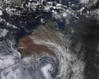
Australia is currently witnessing a meteorological whiplash that defies standard seasonal expectations. In the opening days of May 2026, vast swaths of the continent have seen temperatures climb more than 10 degrees Celsius above the long-term average, shattering records that have stood for decades. This isn't just a "warm spell." It is a massive atmospheric blockage that has trapped tropical air over the southern states, creating a false summer that is about to be violently dismantled by a surging Antarctic front. Within the next 48 hours, residents from Adelaide to Brisbane will experience a thermal collapse, with mercury levels dropping by as much as 15 degrees in a single afternoon.
The immediate cause is a stalled high-pressure system in the Tasman Sea. This system acted as a physical barrier, forcing hot, dry air from the interior to funnel directly into the coastal cities. While the public enjoys an extended beach season, the underlying mechanics reveal a thinning margin for "normal" autumn weather. This record-breaking heat is the setup for a punishing cold snap that will catch the energy grid and the agricultural sector completely off guard. Recently making news lately: Structural Deficits in European Defense Autonomy.
The Mechanics of a Thermal Collapse
Weather doesn't just change anymore; it snaps. The current setup involves a deep low-pressure trough sweeping up from the Southern Ocean, acting like a cold-storage door being kicked open. As this front marches toward eastern Australia, it will collide with the stagnant, record-warm air mass currently sitting over New South Wales and Queensland.
When these two extremes meet, the result is rarely a gentle transition. We are looking at a period of intense atmospheric instability. This includes the high probability of "dry lightning" and damaging wind gusts that precede the actual rainfall. The transition is governed by the pressure gradient force—the sharper the difference in pressure between the warm high and the cold low, the more violent the winds. Because the current heat is so anomalous, the gradient is exceptionally steep. Further details on this are covered by USA Today.
Farmers in the Murray-Darling Basin are particularly exposed. Many have already pivoted their planting schedules based on the early May warmth, only to face a sudden, deep frost that could kill off young shoots. This is the volatility that current climate modeling warns about: the "average" temperature remains high, but the path to get there is a jagged line of extremes that makes traditional land management almost impossible.
Why the Grid Cannot Handle the Whip
Energy analysts are watching the Victorian and South Australian interconnectors with visible nerves. The problem isn't just the heat; it’s the speed of the shift. During the record May heat, air conditioning load stays unexpectedly high, straining aging coal-fired plants that usually undergo maintenance during the "shoulder" seasons of autumn.
When the cold front hits, the demand doesn't drop—it pivots. Within six hours, the load shifts from cooling to heating. This creates a "double peak" that puts immense pressure on the frequency control ancillary services (FCAS). If the wind accompanying the front is too high, wind farms are forced to shut down for safety, precisely when the grid needs them to cover the surge in heating demand.
We are operating on a system designed for a three-month summer and a three-month winter. We no longer have those seasons. We have a chaotic mix where a Tuesday in May requires maximum cooling and a Thursday requires maximum heating. The infrastructure is screaming under the strain of this atmospheric bipolarity.
The Hidden Cost of the False Summer
Psychologically and economically, this warmth carries a price tag. Retailers have already stocked winter apparel, yet heavy coats sit on racks while people buy sunblock. This might seem trivial, but it disrupts the supply chain flow that keeps the retail economy liquid.
More concerning is the impact on water evaporation rates. The record heat in the first week of May has stripped moisture from the topsoil at a rate usually seen in January. For the eastern seaboard, which is still recovering from long-term rainfall deficits in specific catchments, this "bonus summer" is a theft of water resources.
The Frontal Timing
The timeline for the thermal collapse follows a predictable, if aggressive, path:
- Adelaide and Melbourne: The drop began late Friday, with temperatures falling from 28 degrees to a damp 14 degrees overnight.
- Canberra and Sydney: Saturday afternoon sees the arrival of the gusty change. Sydney will likely hold onto the mid-20s until the front crosses the Blue Mountains, at which point the temperature will plummet.
- Brisbane: The warmth will linger longest here, with record-breaking Sunday temperatures likely before the front flattens the heat by Monday evening.
The Jet Stream is Losing Its Grip
To understand why May is behaving like March, we have to look 10 kilometers up. The jet stream—the river of air that steers weather systems—has become "wavy." Instead of a tight, fast-moving circle around the pole, it is looping in deep undulations.
One of these loops has pulled tropical air far further south than it belongs. Another loop, right behind it, is pulling Antarctic air far further north. This is why the "middle ground" of autumn has vanished. We are now a continent of extremes, caught in the kinks of a slowing jet stream.
The "record-breaking" headlines often miss the structural reality. These records aren't just being broken; they are being obliterated by margins that shouldn't be statistically possible in a stable system. When a May record is broken by 3 or 4 degrees, it suggests the baseline has moved.
Preparing for the Cold Shock
The health implications of a 15-degree drop in 24 hours are significant. Respiratory issues spike during these "weather cliffs" as the body struggles to regulate internal temperature against a rapidly cooling external environment.
For those in the path of the front, the advice is simple: do not trust the morning sun. The clear skies currently visible across Sydney and Brisbane are the "calm before the front." By the time the wind shifts to the south-west, the window for preparation—securing loose outdoor furniture or checking on vulnerable neighbors—will have closed.
The cold front moving toward eastern Australia is a reminder that in 2026, the weather is no longer a backdrop; it is an active, unpredictable participant in our daily economy. The record warmth wasn't a gift; it was a warning of the volatility to come.
Check your insulation, monitor the radar, and ignore the blue sky. The frost is coming for the flowers you planted in the heat.