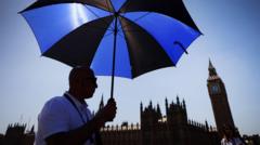
The British weather dial just shattered. On Monday, Kew Gardens in west London hit a staggering 34.8°C. Let that sink in for a second. We aren’t in July or August. It is May.
Historically, late spring in England means light jackets, patchy rain, and optimism for a decent summer. Instead, a massive high-pressure system has trapped a plume of hot air sweeping up from northern Africa, creating a brutal "heat dome" over western Europe. The Met Office confirmed that this is officially the hottest May day since UK-wide records began in 1884.
We aren't just breaking records. We are obliterating them. The previous all-time May record of 32.8°C had stood since 1922 and was only ever matched once, in 1944. Weather records are usually broken by tenths of a degree. Jumping by a full two degrees in one go is unheard of.
The Anatomy Of An Unprecedented Spring Scorcher
This isn't a standard sunny bank holiday. This is extreme summer weather arriving two months early. The sheer scale of the heat across the country tells the story. Heathrow Airport hit 33.5°C early on Monday afternoon, while places like Teddington in Middlesex reached 34°C, and Benson in Oxfordshire sweltered at 33.6°C.
Official heatwave conditions have triggered across wide swaths of England. Areas like Santon Downham in Suffolk, Northolt in London, and Writtle in Essex are feeling the worst of it. The heat isn't staying south, either. Temperatures above 30°C are stretching up into northern England and pushing west into Wales.
Location          Temperature (25 May 2026)
Kew Gardens       34.8°C
Teddington        34.0°C
Heathrow Airport  33.5°C
Worse, the nights offer no relief. Sunday night saw the mercury drop to just 19.4°C at Kenley in Greater London. Londoners barely missed an official "tropical night"—defined as an overnight temperature that stays above 20°C. The UK has never recorded a tropical night in May. Forecasters state we will likely see two of them back-to-back on Monday and Tuesday night.
Why 35C In May Is A Genuine Emergency
It is easy to look at the photos of crowded beaches in Bournemouth or families playing in the fountains at Regent's Park and think this is just a bonus summer. It isn’t.
Our housing stock is uniquely unsuited for this. UK homes are built like thermal flasks. They are engineered to trap heat inside during chilly winters, relying on brick insulation and double glazing. When a heat dome strikes, these houses turn into brick ovens. Without air conditioning, which fewer than 5% of British homes possess, indoor temperatures can easily soar past the outdoor reading.
The UK Health Security Agency has already issued amber heat-health alerts for five English regions. This is a direct warning that vulnerable populations, the elderly, and those with underlying respiratory conditions are under immediate threat. When your body cannot cool down at night because the room is stuck at 24°C, cardiovascular strain skyrockets.
Climate Change In Action
This heatwave is a symptom of a larger structural issue. A Met Office study published last year noted that the likelihood of crossing the historic 32.8°C May threshold has tripled due to human greenhouse gas emissions. Europe is currently the fastest-warming continent on earth.
Just last week, government climate advisers warned that the UK is currently built for a climate that no longer exists. Our infrastructure—from buckled rail tracks to melting tarmac and unventilated hospital wards—is failing to keep pace with reality.
We saw the absolute limit of British infrastructure back in July 2022 when temperatures crossed 40°C for the first time. Reaching nearly 35°C in May means the window of safe, temperate weather in the UK is shrinking fast. To make matters more complicated, meteorologists are watching the early signs of a super El Niño event developing in the Pacific. While its peak global impact won't hit until 2027, it is already supercharging weather volatility this year.
What To Expect Next
If you are waiting for a sudden cool breeze, you will need to hold out a bit longer. The Met Office expects this extreme pattern to hold firm for several days.
Tuesday is set to mimic Monday, with peak highs of 35°C likely in London, Cambridgeshire, and the Home Counties. Wednesday drops slightly to 31°C, Thursday stays hot at 30°C, and we won't see temperatures fall below the late-twenties until Friday at the earliest.
Stop treating this like a normal sunny week. If you are managing a property, open windows only when the outside air is cooler than the inside air—typically late at night or early in the morning. Keep curtains blocked on south-facing windows during the day. Check on older neighbors who might be trapped in top-floor flats. This isn't a fluke holiday bonus. It's a preview of the new normal.