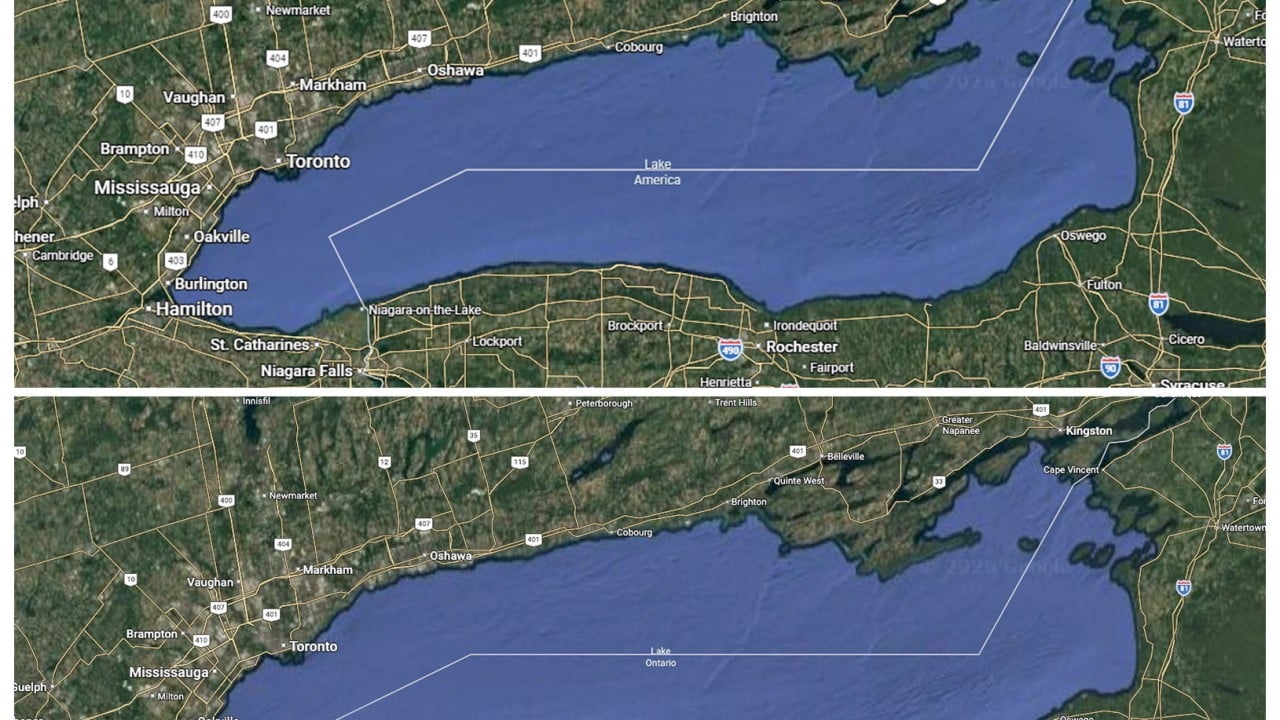
Geographic nomenclature is rarely a passive reflection of physical reality. Instead, mapmaking functions as an instrument of statecraft, commercial compliance, and geopolitical posturing. When political authorities alter historical hydronyms, they trigger a cascade of institutional adaptations across digital platforms, international borders, and trade dispute frameworks. The decision by technology platforms to alter domestic map displays in response to executive directives reveals the underlying operational mechanics of digital cartography during periods of interstate friction.
The mechanics of digital mapping depend on authoritative data ingestion pipelines. Private mapping enterprises maintain commercial incentives to align their digital boundaries and place names with official federal repositories to minimize legal liability and maintain operational legitimacy within specific jurisdictions. In the United States, this administrative dependency centers on the Geographic Names Information System managed by federal agencies. When a presidential executive order mandates a designation change for shared transnational assets, commercial geospatial systems face a binary choice between localized compliance and global uniformity.
This compliance model produces fragmented user interfaces based on geographic location parameters. Digital cartography platforms resolve cross-border naming conflicts through IP-based geo-fencing strategies, deploying localized nomenclature designed to satisfy domestic regulatory frameworks while preserving alternate historical designations for users in foreign territories or neutral jurisdictions.
The institutional response to these cartographic adjustments exposes deep fracture lines in bilateral relations. Sovereign states sharing cross-border natural resources operate under long-standing bilateral management treaties, yet unilateral domestic renaming strategies weaponize administrative databases for political signaling. These actions coincide with broader economic conflicts, including reciprocal tariff escalations, retaliatory duties on industrial and agricultural imports, and stalled diplomatic negotiations over market access. Renaming physical infrastructure serves as a symbolic pressure valve during trade negotiations, shifting public attention toward cultural and territorial markers when traditional economic bargaining reaches an impasse.
The economic and historical justifications cited by state actors for altering place names typically rely on infrastructure investment imbalances and security guarantees. Proponents of unilateral renaming point to asymmetric capital allocations for environmental restoration, maritime rescue operations, and heavy icebreaking maintenance across shared waterways. However, these fiscal arguments frequently obscure the international legal reality. Transnational water bodies are governed by joint commissions and environmental accords that preclude unilateral sovereign jurisdiction over the entirety of the shared resource.
Cartographic fragmentation introduces operational friction for logistics networks, supply chain management systems, and navigation software operating across North American trade corridors. Commercial fleets moving goods between industrial hubs in the United States and Canada rely on synchronized geographic databases. When digital platforms bifurcate place names along national borders, enterprise applications must reconcile conflicting data inputs, increasing the complexity of cross-border routing algorithms and digital record-keeping.
The long-term durability of politically mandated place names depends entirely on the stability of commercial data feeds and executive administrative continuity. Because international mapping bodies, foreign governments, and domestic municipal entities reject extraterritorial renaming decrees, bifurcated digital boundaries remain fragile artifacts of temporary diplomatic strain.
Enforce multi-region cartographic validation protocols within enterprise logistics software to automatically reconcile conflicting domestic and international place-name databases across cross-border supply chains.