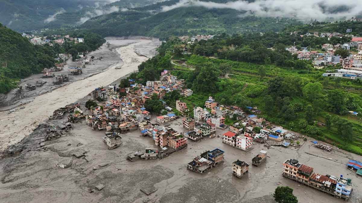
When a massive wall of water and debris tore through the border regions of Nepal and Tibet, stripping away villages and leaving hundreds missing, the initial assumption pointed straight to tectonic violence. Seismometers lit up, and early reports blamed an earthquake. But that narrative was entirely wrong.
The United States Geological Survey later set the record straight. No tectonic plates shifted to cause the disaster. Instead, a catastrophic glacier collapse high in the mountains triggered an ice-and-rock avalanche that sent a wall of mud and water barreling downstream.
If you want to understand why the Himalayas are growing increasingly volatile, you have to look past simple earthquake fault lines and examine the fragile ice hanging above these valleys.
Decoding The Seismic Confusion
Why did global monitors initially think an earthquake hit the Nepal-China border? When millions of tons of ice, rock, and debris suddenly detach and plummet down a mountain face, the sheer kinetic energy registers on seismic equipment just like a natural tremor.
The USGS initially flagged a magnitude 4.4 event. After analyzing long-period seismic waves and comparing them with high-resolution satellite imagery from Planet Labs, scientists realized their mistake. The ground motion wasn't tectonic. It was a massive mass-wasting event—a colossal landslide of glacial ice that packed the punch of a 5.2 magnitude earthquake.
This distinction matters. Earthquakes shake the ground outward, but a glacial collapse dumps immediate, heavy debris directly into narrow river channels like the Lhende Khola, a tributary feeding the Bhote Koshi.
The Anatomy Of A Himalayan Flash Flood
The mechanics of this disaster unfolded with terrifying speed. There was no heavy rainfall in the region to warn locals. The danger came entirely from above.
An ice-rock avalanche broke free, slamming into the river and creating a temporary, unstable dam. Water pooled behind this makeshift barrier until the pressure became too great. When the blockage blew out, it unleashed an unchecked torrent.
The resulting debris flow wiped out roads, bridges, hydropower plants, and entire settlements in the Rasuwa district and across the border in Tibet. With over 150 people confirmed dead and hundreds more—including international tourists and pilgrims—listed as missing, rescue teams faced pitch-black conditions after local electrical grids and infrastructure collapsed.
Why High-Altitude Monitoring Must Change
We can't treat these events as freak accidents anymore. The Himalayas are warming at an alarming rate, destabilizing high-altitude ice fields and creating dangerous conditions that traditional seismic networks aren't originally built to instantly diagnose.
When monitors rely solely on automated earthquake alerts, emergency responders waste precious minutes looking for fault lines instead of tracking downstream water displacement. Climate researchers and disaster management agencies are now forced to integrate real-time satellite telemetry with local hydrology data.
If you live, travel, or work near high-mountain river basins in South Asia, understanding that sudden floods can happen on a clear day without warning is vital. Governments and local communities must upgrade early-warning sensors directly below unstable glacial zones to buy minutes that save lives. Check local district advisories, avoid building permanent structures in narrow river gorges, and support regional hydrometeorological monitoring initiatives before the next high-altitude thaw triggers another crisis.