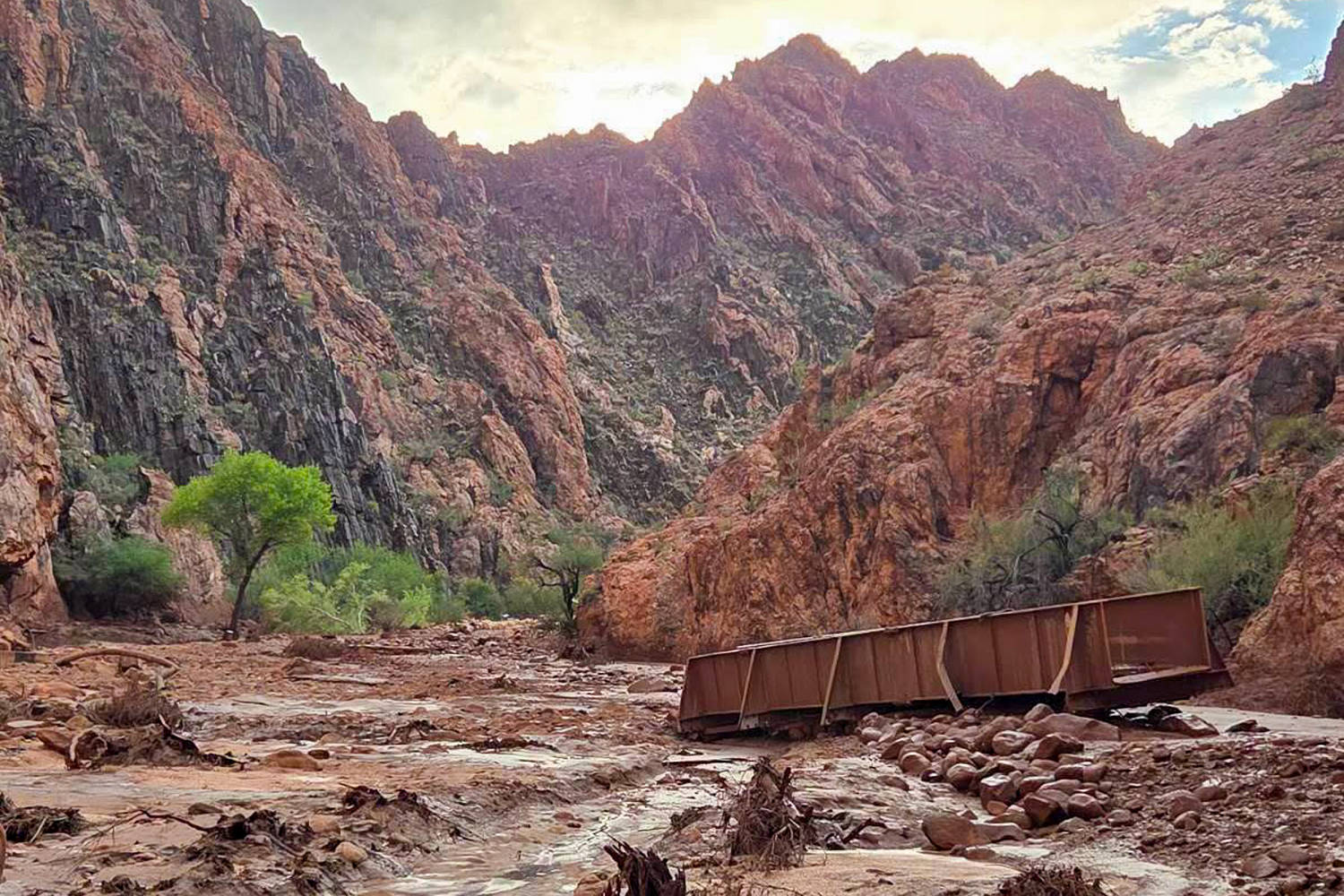
Flash flood events in canyon environments represent extreme hydrological compression where precipitation volume across an expansive catchment basin funnels instantly into narrow subterranean and surface corridors. When meteorological anomalies discharge intense rainfall over impermeable desert sandstone, the resulting surface runoff exhibits near-zero infiltration rates. The hydrological conversion efficiency approaches unity, translating millimeters of direct precipitation into catastrophic hydraulic surges within minutes. Understanding the operational dynamics of these events requires isolating the variables that govern flash flood velocity, topographical funneling, and emergency response latency in remote wilderness terrain.
The Hydrological Forcing Function
Runoff generation in the Grand Canyon watershed depends on three primary variables: rainfall intensity, soil saturation capacity, and basin morphometry. Desert environments feature crustal topsoils sealed by biological soil crusts or baked clay layers. When precipitation rates exceed the infiltration threshold, excess water sheet-washes directly into dry tributary washes, known locally as arroyos or slot canyons.
The mathematical formulation of peak discharge during a flash flood event is typically modeled using the rational method or complex kinematic wave equations. The peak discharge volume $Q$ is a function of rainfall intensity $I$, the runoff coefficient $C$, and the drainage basin area $A$:
$$Q = CIAD$$
In canyon geographies, the runoff coefficient $C$ approaches $0.9$ to $1.0$ due to sheer rock faces and compacted sediment. Because tributary networks act as dendritic collection channels, discrete storms spanning separate high-altitude mesas converge simultaneously into main stem corridors. This produces a sudden vertical wall of water and debris, colloquially termed a wall of water, moving at velocities that outpace human transit capacity. Debris loading transforms the fluid dynamics from clean water flow to a hyper-concentrated mudflow or debris flow, multiplying the fluid density and impact force exponentially against any resistance.
Topographical Amplification and Spatial Vulnerability
The physical architecture of the Grand Canyon exacerbates hydraulic force through constrictions. As water moves from broad plateaus down steep amphitheaters and through narrow slot canyons, cross-sectional area decreases sharply. According to the continuity equation of fluid dynamics, where discharge $Q$ equals cross-sectional area $A$ multiplied by flow velocity $V$:
$$Q = A \times V$$
When area $A$ contracts abruptly within narrow gorges, velocity $V$ must increase proportionally to maintain volumetric flow rate. A moderate rise in upper basin accumulation scales into a high-velocity torrent upon entering restricted gorges.
Recreationalists and tourists traversing backcountry trails frequently underestimate spatial vulnerability because local weather at the canyon floor often remains clear while convective thunderstorms rage miles away on the North or South Rims. The temporal lag between upper basin precipitation and lower canyon arrival times creates an informational asymmetry. Victims experience flash floods without antecedent local rainfall warning indicators, rendering visual or auditory early detection impossible until the hydrodynamic wave front is within seconds of impact.
Systemic Constraints in Remote Emergency Response
Search and rescue operations in deep canyon environments face severe operational bottlenecks governed by topography, communication dead zones, and resource deployment latencies. Standard emergency response frameworks rely on rapid vehicular access and localized communication infrastructure, both of which fail entirely below the rim.
| Operational Phase | Constraint Vector | Impact on Survival Probability |
|---|---|---|
| Detection & Reporting | Absence of cellular infrastructure; delayed witness communication from deep interior zones. | Extends time-to-notification from minutes to hours. |
| Aerial Extraction | High winds, narrow canyon walls, downdrafts, and limited rotor performance at altitude. | Prevents immediate helicopter deployment during active meteorological events. |
| Ground Penetration | Steep descent routes requiring technical rope rescue and specialized swift-water gear. | Restricts initial insertion team speed and payload capacity. |
Communication failure represents the primary friction point in wilderness disaster management. Satellite messengers mitigate this partially, but tourist populations rarely maintain uniform adoption of emergency beacon technologies. Consequently, first responders operate reactively rather than proactively, initiating deployment only after missed check-in windows expire or survivors manage to scramble to higher elevation points with signal access.
Quantitative Risk Mitigation and Basin Monitoring
Mitigating casualty rates in high-risk arid hydrological zones requires shifting from reactive rescue paradigms to predictive threshold monitoring. Stream gauges operated by agencies such as the United States Geological Survey provide real-time discharge telemetry, but sparse sensor distribution across remote desert tributaries leaves blind spots in high-frequency flash flood zones.
Effective backcountry navigation in seasonal drainage paths demands continuous evaluation of meteorological radar feeds, specifically tracking precipitable water values and convective storm cell vectors relative to drainage divides. When storm cells anchor over high-relief plateau rims with high drainage densities, the risk profile escalates from standard recreational hazard to imminent systemic threat.
The tactical imperative for land management agencies and backcountry operators involves establishing hard temporal closure protocols for high-risk slot canyons during monsoon seasons or when regional meteorological services issue flash flood watches. Relying on individual risk assessment proves mathematically unviable given the cognitive biases associated with low-probability, high-consequence events. Immediate suspension of internal canyon transit during active convective periods eliminates the variable of human response latency entirely, aligning operational policy with the unforgiving physics of hydraulic compression.
:max_bytes(150000):strip_icc():focal(999x0:1001x2)/dax-shepard-kristen-bell-emmy-awards-101725-84c11999ef38483e8535a5e109735a38.jpg)