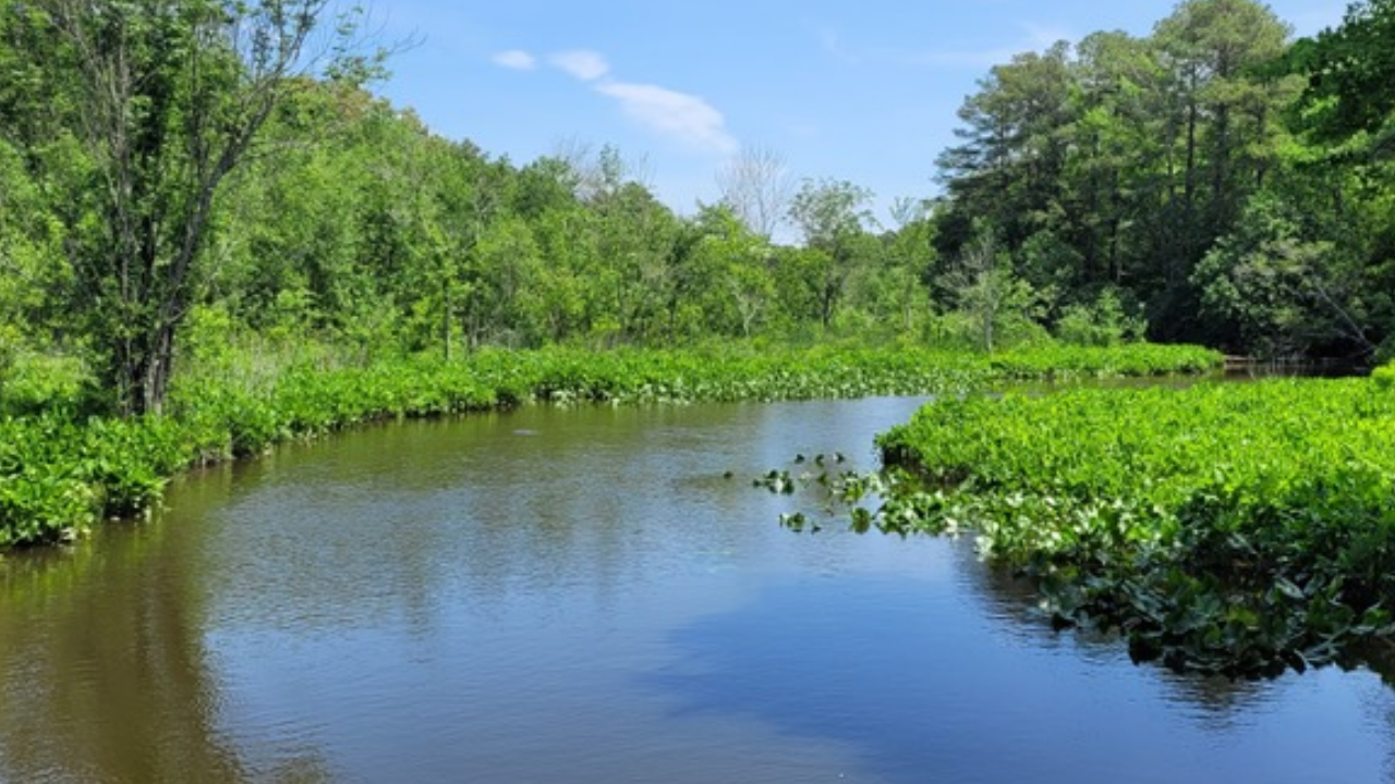
Fifteen years. Six partner organizations. State agencies, federal military buffers, private foundations, and eight family heirs tangled in mid-1800s deed chains.
All of that institutional firepower, administrative overhead, and legal maneuvering went into protecting 181 acres along the Maryland-Delaware border. Recently making news recently: What Really Happened in Spain's Deadliest Rail Disasters and Why the Death Toll Keeps Rising.
Read the standard press coverage on the newly established Henry F. Porter Preserve and the adjacent Porter Tract, and you will see the usual celebratory applause. Journalists love a tidy story about heirs rejecting bulldozers to save Atlantic white cedars and Atlantic sturgeon habitat along the Nanticoke River and Wright Creek. They frame this cross-border pact as an unqualified triumph of modern environmentalism.
They are looking at the wrong scoreboard. More details regarding the matter are detailed by NPR.
Celebrations over 15-year boutique conservation deals obscure an uncomfortable operational reality. When preserving a single 181-acre family tract requires a decade and a half of legal triage and a coalition of half a dozen bureaucracies, the system is not winning. It is barely surviving a war of attrition against suburban sprawl.
The Fifteen-Year Bottleneck Nobody Mentions
The romantic version of land preservation features altruistic families signing papers and wildlife immediately flourishing. The real-world mechanics of the Porter deal tell a much grittier story.
When Henry and Martha Porter bought this property near Seaford in 1950 after moving back from Chicago, land transactions were straightforward. Fast-forward to the 21st century, and the Nanticoke River Watershed Conservancy had to spend more than a decade untangling fractional ownership among eight descendants, burdened by deeds stretching back to the 1800s. Before the ink dried, the Chesapeake Conservancy had to act as a temporary financial bridge buyer just to keep the parcel from fracturing while state agencies sorted out who would hold the bag long-term.
Ask anyone who has actually structured conservation easements or fee-simple acquisitions on the Delmarva Peninsula. You see organizations burn hundreds of thousands of dollars in legal fees, title searches, appraisals, and staff hours just to get a single cross-border deal across the finish line.
Bulldozers do not wait fifteen years. A residential developer with private capital can option farmland, secure zoning variances, and pour concrete in eighteen months. Conservation groups operating on fifteen-year timelines are fighting a modern land rush with nineteenth-century paperwork.
The Myth of "Hands-Off" Preservation
Look closer at how those 181 acres were actually split. Mainstream coverage lumps the entire acreage together under a blanket of untouched wilderness. That is factually wrong, and it masks the sharpest policy divide in modern land management.
The property was bifurcated at the state line into two completely different operational philosophies:
- The Delaware Side (142 Acres): Designated as the Henry F. Porter Preserve, locked down under strict conservation rules managed jointly by the Delaware Department of Natural Resources and Environmental Control and the U.S. Navy.
- The Maryland Side (39 Acres): Absorbed into the Porter Tract of the Chesapeake Forest Lands, funded through Program Open Space and actively leased out for sustainable timber harvesting and public hunting.
Purists hate admitting this, but the Maryland model scales far better than the preservationist lockbox.
Locking up every acre behind pure preservation easements creates an unfunded maintenance liability. Who clears invasive species? Who manages fuel loads so a lightning strike does not incinerate those rare Atlantic white cedars? Who pays for trail upgrades when logging roads are converted for public hiking? Working forests—like the 75,000 acres across Maryland's Eastern Shore managed under the Chesapeake Forest Lands framework—generate revenue, support rural jobs, and maintain early-successional habitat that pure old-growth lockups actually eliminate.
When environmental writers gloss over the fact that 39 acres of this deal will be logged and hunted, they sanitize the exact economic engine that makes large-scale conservation financially viable.
Why the Pentagon Is Really Buying Your Local Woods
Another detail buried three paragraphs deep in standard reports is the presence of the U.S. Navy and the Readiness and Environmental Protection Integration (REPI) program.
Let us drop the polite fiction that federal defense dollars are flowing into the Nanticoke watershed purely out of affection for migratory songbirds. The Department of Defense funds Sentinel Landscapes because suburban rooftops and cell towers ruin military training corridors, radar testing, and low-altitude flight paths.
Military buffer programs are the single most effective land-saving mechanism in the Mid-Atlantic right now.
While traditional environmental grants get bogged down in ideological debates and starved of appropriations, Pentagon readiness budgets move with bipartisan speed. Conservationists realized years ago that framing forest protection around national security unlocks capital that saving turtles never will.
Is that a win for water quality in Marshyhope Creek and the Chesapeake Bay? Yes. Should we pretend it is purely an ecological crusade? No. Relying on military encroachment budgets to save civilian watersheds means conservation priorities get dictated by flight paths and test ranges rather than purely biological urgency. If your threatened wetland does not sit under a Navy flight corridor, good luck getting federal matching funds on a fast track.
Answering the Questions Landowners Are Actually Afraid to Ask
If you own rural acreage, inherited family timberland, or are tracking how watershed deals actually work, standard press releases leave you with useless platitudes. Here is the unvarnished truth behind the questions people actually ask.
Is putting family land into a conservation easement a good financial move?
Usually, no—not if maximizing net worth is your goal. Selling development rights or donating a conservation easement permanently strips the highest-value economic use off your deed. Tax deductions and state Program Open Space payouts rarely match what a residential developer will pay per acre for road-frontage land near growing towns like Seaford. Families do this to prevent sibling partition lawsuits and keep taxes low enough that heirs are not forced to liquidate, not to get rich.
Does protecting 181 acres actually improve Chesapeake Bay water quality?
By itself, 181 acres inside a 725,000-acre Nanticoke basin is a rounding error. It only matters because of spatial adjacency. Because the Porter property connects directly to the Nanticoke Wildlife Area and the Pete Gum Preserve, it prevents edge-effect fragmentation. A standalone 181-acre island surrounded by fertilized row crops and septic tanks does very little to stop nutrient runoff. Connectivity is the only reason this tract punches above its weight.
Why do cross-border conservation deals take so long to close?
Because state bureaucracies treat state lines like international borders even when rivers ignore them. Maryland and Delaware operate under completely separate appraisal standards, funding cycles, title insurance rules, and liability statutes. When a single family farm straddles the Mason-Dixon or transpeninsular line, lawyers essentially have to close two separate real estate transactions simultaneously while praying neither state's budget freezes mid-escrow.
The Hard Trade-Offs of the Contrarian Approach
Pushing for faster, working-landscape deals backed by defense budgets and timber leases solves the speed and funding problem, but it comes with real downsides that honest practitioners cannot ignore.
First, working forests compromise pure biodiversity. Selective timber harvesting disturbs soil hydrology and disrupts interior-forest species that require undisturbed canopy for decades. An active logging road is never ecologically identical to an untouched Atlantic white cedar swamp.
Second, public access degrades sensitive habitats. The Nanticoke River Watershed Conservancy plans to upgrade old logging trails on the Delaware side for public hiking and nature study. The moment you build parking areas and invite foot traffic into previously inaccessible wetlands, you introduce trail erosion, trash, off-leash dogs, and human disturbance to nesting birds. Sometimes the best thing for a wetland is keeping people out of it entirely.
Third, heirs' property reform is unglamorous. Nobody cuts a ribbon for estate planning. Yet the single biggest threat to rural acreage across the Mid-Atlantic is not greedy developers—it is grandparents dying without clear trusts or LLC structures, leaving eight cousins to fight over a tax bill until a partition sale forces the land onto the open market.
How to Actually Save Rural Land Without Waiting Fifteen Years
If conservation agencies, foundations like the Mt. Cuba Center, and rural landowners want to protect the next 3,500 acres in the watershed without burning fifteen years per parcel, the playbook has to change immediately:
- Fund estate planning before land acquisition. Nonprofits should pay rural lawyers to set up family LLCs and succession trusts twenty years before the matriarch passes away. Untangling mid-1800s deeds after an owner dies is malpractice.
- Stop treating timber and hunting as dirty words. Embrace the Maryland Chesapeake Forest Lands model across state lines. Revenue-generating easements allow cash-strapped states to acquire three times as much acreage without begging taxpayers for perpetual maintenance budgets.
- Use bridge capital aggressively. The smartest move in the entire Porter transaction was the Chesapeake Conservancy stepping in to buy the property outright while state agencies dragged their feet. Land trusts need revolving cash funds ready to wire money in thirty days, not grant applications that take thirty months.
- Prioritize corridor connectors over trophy parcels. Use spatial mapping to buy narrow riparian buffers along creeks like Wright Creek and Marshyhope Creek that link existing preserves, rather than blowing entire budgets on isolated, pretty woods.
Henry F. Porter bought his woods in 1950 with a handshake and a deed. It took six institutions and fifteen years to keep his grandchildren from losing them. Stop applauding the marathon and fix the track.