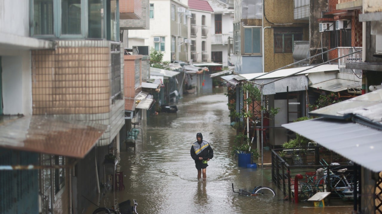
Every time a heavy rainstorm swamps parts of northern Hong Kong, the headlines write themselves. Academics rush to publish risk maps, urban planners clutch their pearls, and panic spreads across property desks. The lazy consensus is simple and terrifying: northern districts like Yuen Long and North District are drowning in escalating climate disaster exposure, making them ticking financial time bombs.
It is a neat narrative. It is also entirely wrong.
I have spent decades watching institutional capital misprice urban vulnerability. I have seen multi-million dollar mandates based on surface-level hazard assessments that ignore the actual engineering and economic reality of how hyper-dense cities function. The standard risk models published by university departments and environmental think tanks rely on static flood plain data and naive elevation projections. They look at a map of northern Hong Kong, see low-lying floodplains and sprawling rural-urban fringes, and slap a catastrophic vulnerability label on the entire sector.
They are confusing exposure with actual risk. And that distinction costs billions.
The Flaw in the Models
To understand why the mainstream panic over northern Hong Kong is a mirage, you have to look at how these disaster models are constructed. They measure physical hazard potential—how much water falls, how high tides rise, and how flat the terrain is—while completely ignoring adaptive capacity, micro-drainage engineering, and real estate turnover rates.
Take the Northern Metropolis development strategy. The standard academic critique treats this massive upcoming economic zone as an impending climate tragedy because parts of it sit on historical agricultural wetlands. What the doom-mongers miss is that greenfield and transitional zones undergo radical hydrological overhauls during development. You are not building on a passive swamp; you are engineering a high-capacity, subterranean drainage grid designed to modern hydrological standards.
When researchers claim northern Hong Kong faces the highest climate disaster risk, they are usually evaluating the area as it existed twenty years ago, not as it is capitalized and engineered today.
Let us define terms. Hazard is the physical event, whether a typhoon or a torrential downpour. Vulnerability is the susceptibility of a population or asset to that hazard. Risk is the product of hazard, vulnerability, and exposure. If you upgrade the drainage, elevate critical infrastructure, and construct buildings with waterproof podiums and automated flood-gate systems, your vulnerability drops close to zero—even if the raw physical hazard remains high.
The academic studies ignore the mitigation variable because it is difficult to quantify in an academic paper. But in the real world of real estate valuation and municipal management, mitigation is the only variable that matters.
The Economics of Urban Resilience
Why do these alarmist studies persist? Because fear sells grants, generates headlines, and justifies municipal interventions. But if you look at where smart capital is actually flowing, the market is calling the academics' bluff.
Land values in the northern sectors are not collapsing. Institutional developers are not abandoning the drawing boards for the Northern Metropolis. They understand a fundamental truth that environmental NGOs refuse to acknowledge: Hong Kong possesses one of the most aggressive, well-funded civil engineering apparatuses on the planet. When the Drainage Services Department targets a flood-prone black spot, concrete, pumps, and subterranean stormwater storage tanks follow swiftly.
I’ve watched firms blow millions on proprietary climate risk SaaS platforms that spit out generic heatmaps built on open-source topography data. These tools tell an executive that a warehouse in San Tin is at high risk of inundation. The executive panics, divests at a discount, and misses the fact that the government has already committed billions to channelize the nearby rivers and build massive underground retention tanks.
That is not risk management. That is financial self-harm driven by algorithmic superstition.
The Real Danger Is Not Climate
By obsessing over theoretical climate disasters in the New Territories, analysts are blinding themselves to the actual systemic risks facing Hong Kong's property and economic ecosystem.
The real threat is not a typhoon flooding a container storage yard in Lok Ma Chau. The real threat is regulatory sclerosis, demographic drag, and the misallocation of capital toward imaginary climate ghost towns while actual infrastructural bottlenecks go ignored.
Consider the "People Also Ask" queries floating around search engines right now: Is northern Hong Kong safe from rising sea levels? Will property values crash due to climate change?
The answers given by consensus articles are cowardly and evasive. They tell you to "consult local experts" or that "long-term projections remain uncertain." Let us drop the diplomatic hedging.
No, property values will not crash because of sea level rise in the north. Yes, the area is safe, provided you possess basic competence in reading civil engineering specifications rather than academic panic sheets. The physical geography of the New Territories does not exist in a vacuum; it is mediated by one of the most interventionist and capable urban engineering states in human history.
To claim that northern Hong Kong is uniquely doomed is to ignore how cities adapt, how engineering nullifies topography, and how markets price-in physical reality long before the academic papers even clear peer review.
Stop pricing real estate based on topographical fairy tales. Look at the drainage blueprints, check the capital expenditure logs, and stop confusing a rainy afternoon with the end of the world.