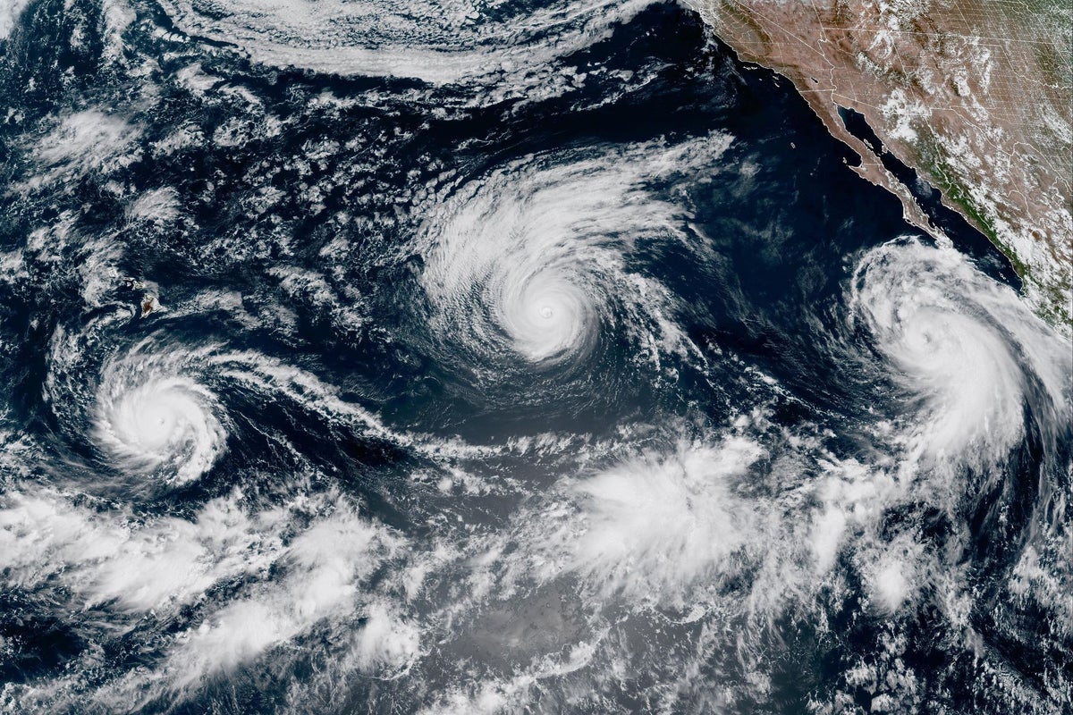
Unusual ocean heating patterns in the equatorial Pacific are already altering the jet stream, threatening to upend standard U.S. weather expectations months ahead of schedule. While routine climate cycles follow predictable seasonal transitions, this anomalous phase is behaving outside historical parameters, leaving meteorologists scrambling to adjust tracking models. The core mechanics of the El Nino-Southern Oscillation dictate how thermal energy transfers from sea to sky, but when baseline oceanic temperatures are already supercharged by long-term planetary warming, textbook rules cease to apply.
The Broken Blueprint of Pacific Teleconnections
For decades, forecasters relied on a standard playbook. An emerging warm phase in the Pacific Ocean typically builds slowly through the summer, consolidates its grip by autumn, and exerts its primary influence on North American weather from January onward. This current cycle has ignored that schedule. Atmospheric pressure anomalies near the dateline are forming with an intensity usually reserved for mature winter events.
Consider how this alters atmospheric momentum. When surface waters warm irregularly, the overlying air expands, ascends rapidly, and punches high into the troposphere. This thermal chimney alters global wind patterns long before traditional teleconnections kick in. The Pacific jet stream, which acts as the main conveyor belt for North American storms, is responding to these early signals by shifting southward prematurely.
Why Traditional Models Are Failing
Predictive computing relies heavily on historical analogs. Weather bureaus feed decades of past ocean buoy data into algorithms to forecast what will happen next. When an event displays characteristics that have no direct historical match, those algorithms start throwing wide margins of error.
Take sea surface temperature gradients. The spatial distribution of the warmth this season is skewed toward the central Pacific rather than the eastern coast of South America. Meteorologists refer to this specific configuration by its technical descriptor, Modoki, or central-Pacific events. These configurations trigger vastly different atmospheric responses than classic eastern-Pacific events.
- The southern tier of the United States faces an early threat of persistent, moisture-laden storms.
- The Pacific Northwest risks sliding into unseasonal dryness much earlier than predicted.
- Atlantic hurricane suppression may fluctuate wildly as upper-level wind shear reacts to the premature Pacific forcing.
Atmospheric scientists are watching these variables closely because the background state of the planet is fundamentally different than it was during the benchmark events of 1982 or 1997. Pairing an atypical ocean cycle with an already warm global atmosphere creates a non-linear response. Linear projections fail because the baseline energy available to storm systems is exceptionally high.
Cascading Risks for Infrastructure and Agriculture
Agricultural planners and municipal water managers are feeling the whiplash. Water distribution systems designed around steady seasonal meltwater and predictable rainfall allocations find themselves vulnerable to sudden shifts. If heavy precipitation slams the Southwest months ahead of schedule, reservoirs designed to capture gradual spring runoff can overflow rapidly, forcing emergency releases.
Conversely, regions dependent on a gradual transition into cooler autumn weather face prolonged heat stress. Soil moisture levels drop rapidly when the atmosphere acts as a giant sponge, pulling water from the earth at an accelerated rate. This dynamic turns what might have been a minor dry spell into a flash drought before winter precipitation even has a chance to form.
Infrastructure vulnerability compounds these agricultural pressures. Coastal municipalities along the Pacific rim deal with combined threats: elevated baseline sea levels driven by thermal expansion, paired with the possibility of high-energy storm surges arriving during an early transition window. When these factors align, structural defenses built to withstand historical storm parameters face immediate testing.
Emergency management agencies are forced to abandon standard seasonal readiness timelines. Waiting until late autumn to stage flood mitigation assets or drought relief programs is no longer viable when the ocean signals a shift during the height of summer.
The atmospheric machinery governing North America has stepped off its traditional track, and the adjustments required to manage the fallout will test the limits of modern forecasting infrastructure.