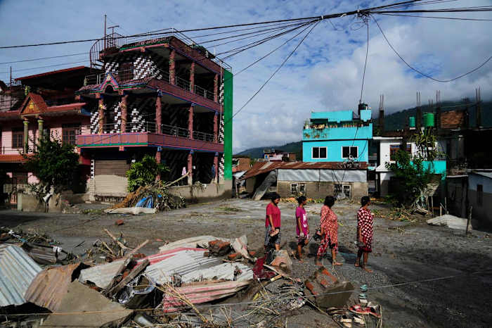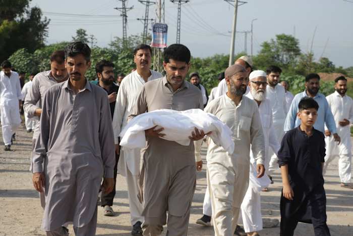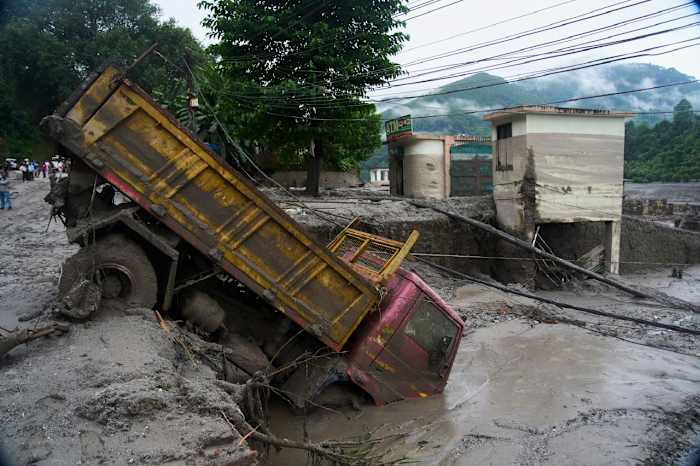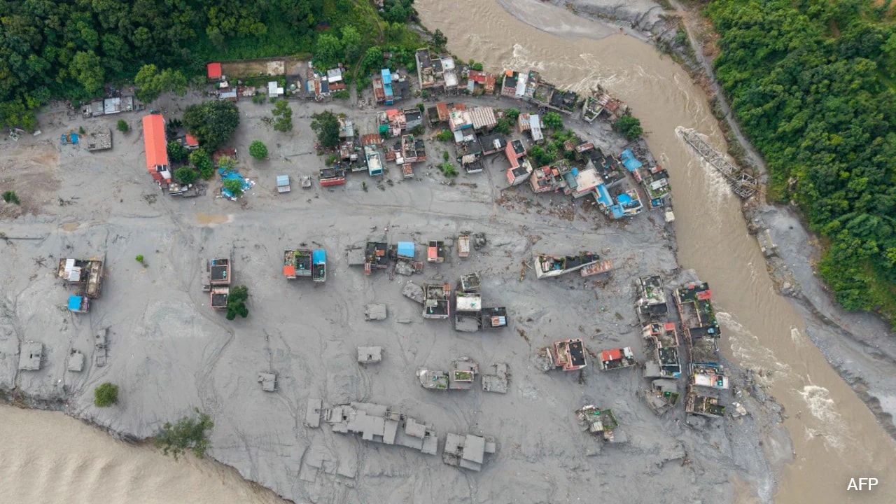
Geography doesn't care about political boundaries. When a wall of water rips through the high-altitude terrain of northern Nepal, it takes less than a day for those same surging currents to barrel into the northern plains of India. If you live anywhere near the transboundary river networks, you already know that water management is a high-stakes game of seconds and survival.
The physical link between Nepal's Narayani River and India's Gandak River system is one of the most volatile hydro-ecological corridors in South Asia. When flash floods hit upstream areas—whether triggered by sudden glacial movements, erratic monsoon outbursts, or seismic activity near the Tibet border—downstream communities in Indian states like Bihar and Uttar Pradesh face immediate danger.
Let's look at how this transboundary pipeline actually operates, why standard defenses keep failing, and what authorities are scrambling to change.
The Geography of Risk Along the Narayani Gandak Corridor
Water starts high in the Himalayas. Rivers like the Trishuli and the Kali Gandaki converge at sacred and strategic points like Devghat in Nepal, swelling into the mighty Narayani before crossing the international border at Valmikinagar to become the Gandak.
This journey sounds simple on a map, but it creates a logistical nightmare during peak monsoon seasons. When heavy downpours or sudden upstream flash floods breach normal thresholds, the time window for warning downstream populations shrinks drastically. Water levels measured at gauges like Devghat can transform from a manageable flow into a critical danger zone within hours.
When a major surge hits, engineering controls become your only line of defense. At the Valmikinagar structure, authorities routinely face the frantic task of opening all 36 barrage gates to manage massive cubic feet per second (cusecs) discharges. Discharging tens of thousands of cusecs keeps barrages from catastrophic structural failure, but it instantly forces downstream districts into emergency evacuation modes.
Real Vulnerabilities Across Bihar and Uttar Pradesh
Downstream exposure isn't distributed equally. Districts sitting right on the border take the first blow. In Bihar, administrative machinery in West Champaran, East Champaran, Gopalganj, Saran, Muzaffarpur, and Vaishali must maintain round-the-clock vigilance whenever upstream telemetry spikes.
Over in Uttar Pradesh, regions like Maharajganj and Kushinagar bear the brunt. Local administrations have to mobilize the State Disaster Response Force (SDRF) and National Disaster Response Force (NDRF) teams, setting up community kitchens and evacuation shelters before roads turn into rivers.
Farmers and rural families living in the low-lying diara (floodplain) pockets face the harshest reality. Their livelihoods depend entirely on fertile silt, yet that same silt-rich water destroys crops, drowns livestock, and erodes homes overnight. Traditional coping mechanisms struggle to keep pace with increasingly erratic climate patterns and shifting weather extremes.
Why Technical Data Sharing Falls Short
You would think that modern satellite technology and real-time hydrological data-sharing between governments would solve this. India and Nepal do maintain joint forecasting mechanisms, but hardware and data are only as good as the response time on the ground.
Communication hurdles, bureaucratic lags, and the sheer speed of Himalayan flash floods mean warnings often arrive with razor-thin margins. When a flood wave travels from upper catchments through narrow gorges, local leaders have mere hours—sometimes minutes—to sound sirens, move elderly residents, and secure livestock.
Critics and environmental experts point out that structural fixes like higher embankments and massive barrages treat symptoms rather than root causes. Riverbeds are rising due to heavy siltation, reducing the overall carrying capacity of the channels. Dredging helps temporarily, but the sheer volume of debris washed down from fragile, earthquake-prone mountain slopes makes permanent containment nearly impossible.
Practical Steps for Transboundary Resilience
If you live in these shared river basins or study regional disaster management, waiting for centralized government rescue operations is never enough. Building true community resilience requires a complete shift in how local populations prepare.
- Invest in decentralized early-warning tech: Communities need automated, solar-powered siren systems directly linked to upstream river gauges rather than relying solely on multi-tiered bureaucratic alerts.
- Adopt flood-resilient agriculture: Shifting toward short-duration crop cycles and flood-tolerant crop varieties helps farmers salvage yields before the worst monsoon weeks arrive.
- Map safe elevation points locally: Every village in high-risk zones across the Gandak basin must pre-identify elevated concrete structures and escape routes that remain accessible even when primary roads submerge.
- Strengthen cross-border data loops: Local district officials on both sides of the border need direct communication channels to bypass national delays during emergency discharge events.
Water will always flow south from the mountains. Learning to live with the river means accepting that rigid walls cannot outsmart geography. Only agile preparation and transparent cooperation will keep these communities safe.