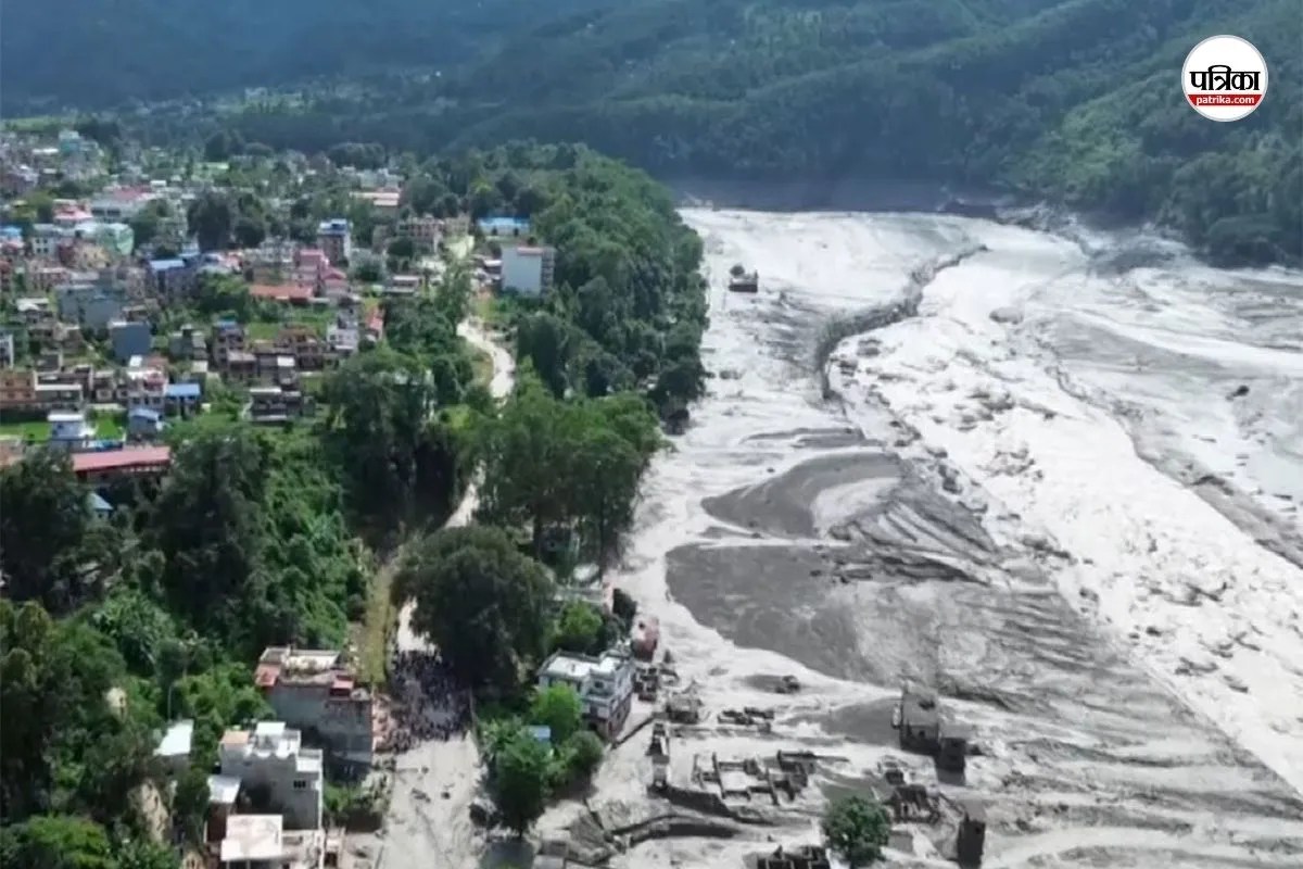
Catastrophic flash floods originating from the Bhote Koshi River basin along the Nepal-Tibet border have disrupted regional stability, leaving more than 579 individuals unaccounted for, including over 400 foreign nationals. Initial reporting from agencies such as Reuters and the Associated Press catalogs the missing by national origin. However, raw counts obscure the underlying operational, logistical, and structural failures governing crisis response and tourist tracking in high-risk Himalayan zones. Deconstructing this event requires shifting from passive tabulation to an examination of data collection integrity, infrastructure vulnerability, and diplomatic mobilization metrics.
The Data Reliability Problem in Cross-Border Disasters
Cataloging missing persons in remote terrain introduces significant variance between preliminary estimates and verified casualties. The Nepal Tourism Board initially compiled lists based on inputs from ten localized travel agencies, registering 384 travelers before broader figures scaled past 500. This methodology creates three distinct data distortions: For an alternative view, consider: this related article.
- Self-Reporting Latency: Independent travelers and spiritual pilgrims trekking toward Mount Kailash or Manasarovar often bypass centralized check-ins, creating an invisible baseline where baseline populations are unknown.
- Communication Blackouts: The destruction of fiber-optic corridors and cellular towers in Rasuwa, Nuwakot, and Dhading districts severed telemetric feedback loops, transforming simple lack of contact into presumed disappearance.
- Administrative Double-Counting: Discrepancies between Non-Resident Indian (NRI) classifications and primary national counts skew bilateral diplomatic registers, delaying targeted resource deployment.
Foreign ministries face an acute information deficit during the initial seventy-two hours post-disaster. When nations like India report upwards of 130 missing citizens, Australia registers 34, and the United States tracks 47, these figures represent consular distress queries rather than confirmed physical locations. Structured crisis management models dictate that until physical infrastructure allows ground teams to clear debris fields, casualty metrics remain speculative vectors driven by family reporting rather than empirical recovery.
Infrastructure Fragility and Hydro-Geological Vectors
The disaster was triggered not by seismic activity, but by sudden glacial and mudslide surges originating upstream in Tibet, which overwhelmed narrow river gorges and swept away critical transit corridors. The economic and human cost is directly proportional to the density of infrastructure placed within high-risk alluvial fans. Further insight on the subject has been provided by BBC News.
Hydropower installations and historical trade arteries share identical topographical constraints. The 20-megawatt Langtang Khola Hydropower Project and associated worker camps sat squarely within the hydraulic path of the flash flood, trapping personnel who lacked early-warning telemetry. Traditional mountain tourism models prioritize access and scenic proximity over hydrological safety margins. When bridges across the Trishuli River collapse, evacuation vectors drop to zero, transforming transit routes into logistical traps.
Diplomatic Mobilization and Consular Response Metrics
The distribution of missing persons maps directly to regional tourism demographics and pilgrimage schedules. The convergence of Indian, Western, and East Asian nationals in the Rasuwa sector triggered a multi-lateral consular response.
Bilateral coordination relies on clear operational frameworks. India deployed border security teams and high-level ministerial communication channels to monitor downstream effects across Bihar and Uttar Pradesh, where the Gandak and Kosi river systems absorb the surge. Conversely, distant nations rely entirely on third-party verification from local authorities, creating a multi-layered verification bottleneck. Consular efficacy is bounded by ground-level access; until the Nepal Army and security forces clear blocked roads and restore aviation pathways hampered by adverse weather, embassies remain restricted to administrative triage rather than active extraction.
Deploy heavy-lift aerial reconnaissance to establish real-time perimeter mapping of inaccessible gorges before committing ground rescue teams to high-risk secondary flood zones.