The emergence of unidentified individuals from municipal manholes represents a critical breach of urban infrastructure security, exposing a systemic failure in subterranean physical access control. While mainstream media reports treat these incidents as isolated anomalies or local mysteries, a structural analysis reveals them as symptoms of a broader vulnerability: the unmonitored intersection of public utility networks and urban perimeters. Municipalities routinely fail to secure underground conduits, treating subterranean pathways as passive utility channels rather than active, high-risk transit corridors.
To understand the operational mechanics of these security failures, the problem must be deconstructed into three core vectors: the physical accessibility of the infrastructure, the regulatory and monitoring deficits of municipal management, and the tactical utility of subterranean networks for unauthorized transit.
The Three Vectors of Subterranean Vulnerability
Subterranean urban infrastructure—comprising storm drains, sanitary sewers, telecommunications vaults, and electrical distribution tunnels—presents a unique asymmetric security risk. The system is designed for high accessibility by municipal workers but features negligible access barriers against motivated intruders.
1. The Physical Accessibility Vector
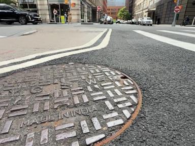
The primary failure point of underground utility networks lies in the design philosophy of the entry points. Manhole covers are engineered primarily for weight-bearing capacity and ease of removal by maintenance crews, not for security.
- Mass and Gravity Dependency: Standard municipal manhole covers rely almost exclusively on their dead weight (typically between 90 to 150 pounds) to prevent displacement. While sufficient to deter casual tampering, this weight offers zero resistance to individuals equipped with basic mechanical leverage tools, such as standard manhole hooks, pry bars, or hydraulic jacks.
- Interconnected Conduits: Once an entry point is compromised, the lack of internal physical barriers allows for lateral movement across vast urban distances. Storm water systems and legacy utility tunnels frequently run parallel to or intersect with high-security zones, residential sectors, and commercial hubs, serving as unmonitored subterranean highways.
2. The Monitoring and Information Asymmetry Vector
Municipalities face a structural deficit in real-time situational awareness regarding their underground assets. This deficit stems from specific technical and budgetary constraints.
- Attenuation of Signal Transmissions: Subterranean environments naturally inhibit standard wireless communication protocols (RF, cellular, GPS). Deploying electronic monitoring systems requires specialized, hardened infrastructure capable of operating in high-humidity, corrosive, and signal-dead environments.
- Delayed Detection Windows: Traditional security assets—such as closed-circuit television (CCTV) cameras and motion sensors—are overwhelmingly deployed above ground, focused on surface perimeters. Consequently, an intrusion remains undetected until the subjects exit the system into a monitored surface zone, leaving the duration and trajectory of the subterranean transit entirely opaque to law enforcement.
3. The Tactical Utility Vector
For unauthorized actors, the choice of subterranean transit over surface transit is dictated by a clear optimization function. The underground network provides absolute visual occlusion from surface surveillance, insulation from weather anomalies, and the ability to bypass physical surface checkpoints such as fences, gates, and manned security posts.
The Cost Function of Subterranean Infiltration
The proliferation of these security breaches can be modeled through an economic and operational cost function. Unauthorized actors select transit routes by minimizing the total operational cost ($C_{total}$), which can be mathematically conceptualized as:
$$C_{total} = E_{physical} + T_{transit} + P_{detection} \cdot P_{apprehension}$$
Where:
- $E_{physical}$ represents the physical effort and equipment required to breach the entry point.
- $T_{transit}$ is the time spent navigating the subterranean environment.
- $P_{detection}$ is the probability of detection while inside the system.
- $P_{apprehension}$ is the probability of law enforcement or security personnel successfully intercepting the actors during or immediately after the breach.
In most modern municipal frameworks, $P_{detection}$ within the tunnel network approaches zero. Because the physical effort ($E_{physical}$) requires only basic, widely available tools, the total operational cost for an intruder is exceptionally low. Until municipalities artificially inflate these variables—specifically $E_{physical}$ via mechanical locking mechanisms and $P_{detection}$ via sensor deployment—the subterranean network remains a highly efficient path of least resistance.
Technical Deficiencies in Municipal Response Protocols
When law enforcement agencies respond to reports of "mystery men" emerging from manholes, the operational response typically suffers from standard tactical errors rooted in a lack of specialized training and equipment.
Structural Lack of Subterranean Maps
First responders rarely possess integrated, real-time spatial data representing the subterranean grid. While surface maps are highly detailed, utility maps are frequently siloed across different departments (e.g., water management, private telecom providers, electrical cooperatives). During an active incident, a responding officer cannot readily determine where a specific manhole leads, what intersecting tunnels exist, or where the optimal interception points are located on the surface.
Environmental and Tactical Hazards
Entering a compromised utility network without specialized breathing apparatus and atmospheric monitoring equipment exposes personnel to lethal concentrations of toxic gases (such as hydrogen sulfide and methane) or oxygen-depleted environments. This structural hazard prevents immediate pursuit, creating a significant temporal buffer that favors the intruding party.
The Exit Point Multiplex
A single subterranean corridor can feed into dozens of surface exit points. Standard police containment protocols are designed for two-dimensional surface perimeters. When forced to contain a three-dimensional subterranean network with multiple unmapped exit vectors, the required manpower scales exponentially, rendering effective containment mathematically improbable with standard shift deployments.
Operational Hardening Framework
Remediating these vulnerabilities requires shifting municipal strategy from a reactive law enforcement model to a proactive, infrastructure-hardening framework. This transition involves deploying specific physical and digital countermeasures systematically across high-risk zones.
Implementation of Mechanical Access Controls
The most immediate reduction in vulnerability is achieved by eliminating reliance on gravity-based manhole retention. Municipalities must deploy high-security, tamper-resistant locking mechanisms.
- Internal Lock Bars: Installing retrofitted mechanical lock bars beneath the manhole cover prevents removal even if the cover is pried loose from its frame. These locks require a proprietary, high-security key or tool to disengage from the surface.
- Cam-Locking Systems: Utilizing rotating cam systems that lock into the cast-iron frame of the manhole structure ensures that any lifting force applied without the correct key is distributed across the entire embedded frame, requiring destructive force to breach.
Deployment of Subterranean Sensor Networks
To solve the detection deficit, the underground environment must be integrated into the city’s smart infrastructure grid.
- Tamper-Evident Limit Switches: Installing low-power, ruggedized limit switches or proximity sensors directly beneath the manhole seat provides instantaneous alerts the moment a cover is lifted. These sensors can be linked to low-power wide-area networks (LPWAN), such as LoRaWAN, which feature superior signal penetration characteristics through concrete and asphalt compared to traditional cellular networks.
- Acoustic and Fiber-Optic Sensing: Utilizing distributed acoustic sensing (DAS) via existing underground fiber-optic cables allows municipalities to detect footsteps, digging, or structural vibrations inside the tunnels. This technology transforms passive data cables into a continuous sonar-like surveillance array, pinpointing the location of intruders without requiring thousands of individual cameras.
Unified Asset Mapping and Interagency Integration
Municipalities must synthesize disparate utility data into a centralized Geographic Information System (GIS) accessible to emergency services in real time. This system must cross-reference utility ownership, tunnel dimensions, connectivity matrices, and surface exit coordinates, allowing incident commanders to instantly calculate containment zones based on the estimated transit speed of intruders within specific tunnel diameters.
Strategic Forecasting and Risk Mitigation Priorities
The systematic exploitation of urban utility tunnels represents an evolving security frontier that will increasingly intersect with transnational migration vectors, criminal transport logistics, and asymmetric gray-zone tactics. Municipalities that continue to treat subterranean spaces as simple plumbing infrastructure will face escalating containment failures.
Resource allocation must prioritize the immediate physical securing of all manholes and access vaults located within a 500-meter radius of critical infrastructure nodes, government installations, and high-density transportation hubs. Following the physical securing of these primary perimeters, the second phase must focus on integrating LPWAN-enabled tamper sensors into the broader municipal emergency response network.
The era of managing cities purely from a surface perspective is obsolete; comprehensive urban security now demands absolute administrative and physical control over the subsurface dimensions of the metropole.


