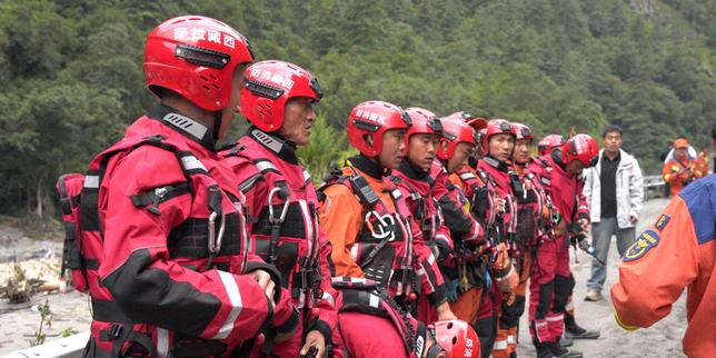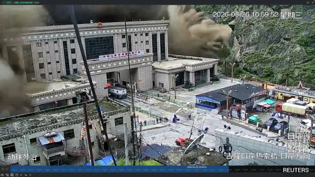
China has officially suspended emergency search and recovery operations at the epicenter of a catastrophic mudslide along the Tibet-Nepal border, forced to pull back frontline crews as an unstable, debris-dammed lake threatens to burst its banks and unleash a secondary torrent downstream. State media reports indicate that hundreds of people remain missing following the initial disaster that struck the border hub of Gyirong. Now, engineers and rescue workers face an agonizing standstill. Water levels behind the makeshift earthen dam—sculpted by millions of tons of fallen rock, ice, and soil—are rising rapidly under persistent rainfall, expected to peak perilously. For the families waiting at the perimeter, the pause is an agonizing sentence. For disaster management experts watching from afar, it is the realization of a terrifying, recurring high-altitude vulnerability.
Anatomy of a High-Altitude Catastrophe
The immediate trigger was not merely heavy rain, but a catastrophic failure high above the valleys. Cryospheric researchers and geological surveys point to a massive section of glacial ice and rock breaking away, plummeting down steep gradients with the kinetic force of a freight train. When this slurry hit the river systems, it slammed shut like a geological valve.
A natural dam formed almost instantly. Behind this unstable barrier, water pooled at terrifying speeds, creating a ticking time bomb of mud and liquefied stone. When the pressure finally breached the makeshift barrier, a wall of water surged across the borderlands, scouring riverbeds, wiping out infrastructure, and trapping workers miles away in subterranean tunnels like those at the Trishuli project in neighboring Nepal.
The geography of the Hindu Kush Himalaya region makes rescue operations uniquely perilous. Valleys are narrow corridors of rock, leaving zero margin for error when water levels fluctuate. When state broadcaster CCTV reported that teams operating near Gyirong Port had been ordered to withdraw one kilometer to safer high ground, it underscored a brutal operational reality: nature dictates the timeline, and human technology remains secondary to raw gravitational physics.
The Engineering Nightmare of Debris-Dammed Lakes
Managing a post-disaster flood zone of this magnitude requires a delicate calculus of risk, and usually, the math does not favor intervention. When a landslide or glacier collapse forms an impoundment lake, engineers face a nightmare scenario.
If the water is left alone, the rising volume will eventually breach the earthen debris wall catastrophically, sending a wall of water downstream with zero warning. If heavy machinery is brought in to carve an artificial spillway, the vibrations or accidental destabilization of the loose rock can trigger an immediate, premature rupture.
[Glacier Collapse / Landslide]
       │
       ▼
[Debris Impoundment Barrier]
       │
       ▼
[Rapidly Rising Upstream Lake]
       │
       ├─► Option A: Uncontrolled Breach (Catastrophic Downstream Surge)
       └─► Option B: Controlled Drainage (High Risk to On-Site Engineers)
Rescue coordinators on the ground are caught in this exact trap. Drone-based three-dimensional modeling and thermal imaging are currently scanning the perimeter, attempting to map the structural integrity of the debris wall from a safe distance. Yet, technology cannot reinforce loose mud and shattered rock against relentless monsoon-style precipitation. The decision to halt active digging and pull personnel back is an admission of tactical helplessness against an environment that refuses to stabilize.
Geopolitical and Cross-Border Vulnerabilities
Disasters do not respect sovereign demarcations, least of all in the jagged, contested topography of the Himalayas. What begins as a localized mudslide in Tibet rapidly mutates into a multi-nation humanitarian crisis stretching hundreds of kilometers south into Nepal.
Downstream communities along the Trishuli and surrounding river networks bear the brunt of water surges originating miles away in high-altitude Chinese territory. Communication delays, complex bureaucratic hurdles, and the sheer logistical nightmare of moving heavy equipment across high mountain passes complicate relief efforts. While specialized Chinese engineering teams deploy advanced monitoring gear on their side of the border, downstream search parties in Nepal rely on aviation assets that struggle just to locate entry points of flooded infrastructure.
This disaster exposes a systemic fragility in regional infrastructure planning. Hydropower stations, trade ports, and mountain highways are increasingly built in narrow river corridors to harness the immense energy of the terrain. Every decade, the margins for safety shrink as environmental pressures mount.
The Broader Environmental Shift
Dismissing these events as isolated anomalies ignores the changing baseline of the Third Pole. Scientists studying the Hindu Kush Himalaya emphasize that accelerated glacial thinning and permafrost degradation are fundamentally rewriting the stability of high-altitude slopes.
When subterranean ice melts within a mountain's core, it acts like removing mortar from a brick wall. The entire geological structure becomes prone to sudden, massive structural failures under minimal provocation. Warmer air holds more moisture, leading to intense localized cloudbursts that saturate topsoils and trigger chain reactions of rockfalls and flash floods.
The human cost is measured in the hundreds confirmed dead, thousands displaced, and scores of families searching through unrecognizable landscapes for loved ones. As long as infrastructure development pushes deeper into these fragile gorges without accounting for catastrophic cryospheric shifts, pauses in rescue operations will transition from rare emergencies to expected milestones of disaster response.
For now, the machinery sits silent on the Tibetan plateau. The lake continues to swell. Downstream, communities watch the riverbanks and wait for a drop in the water level that may take days to arrive.